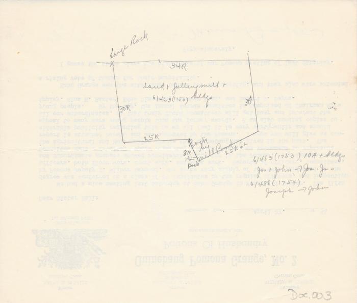
Safford land map 1753 & 1754
7.25" H
X
8.5" W
Coll. 003 Fold. 038 Doc. 003 Safford land map 1753 & 1754
One 1/2 sheet of scrap paper with unrelated material on the reverse side. The map is written in pencil. Information found in Volume 6 pp. 463 and 486 Belonging to first Joseph & John Sanford and then Joseph Jr. and in 1754 from Joseph to John.
One 1/2 sheet of scrap paper with unrelated material on the reverse side. The map is written in pencil. Information found in Volume 6 pp. 463 and 486 Belonging to first Joseph & John Sanford and then Joseph Jr. and in 1754 from Joseph to John.
Coll. 003 Fold. 038 Doc. 003