Colorized maps of Preston, CT 1868 with insets of Poquetanock and Preston City
1868 (Date manufactured/created)
13" H
X
16" W
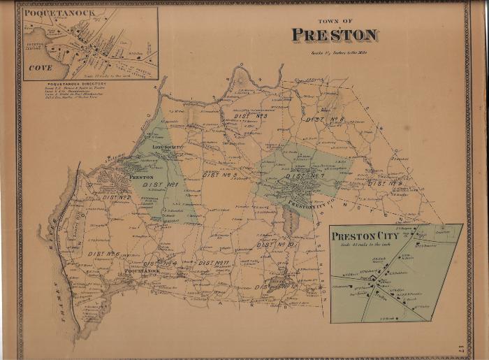
Coll. 001 Fold. 027 Doc. 001 and Doc. 002 Colorized maps of Preston, CT 1868 with insets of Poquetanock and Preston CityTwo of the same maps of Preston, CT in 1868. The two areas colorized in green are Preston City and Long Society. Doc. 001 is missing a section on the right, and is ripped along all edges. Doc. 002 is glued to cardboard and other than being a little darker around the edges. There is a Poquetanuck Directory under the Poquetanuck inset map.
Coll. 001 Fold. 027