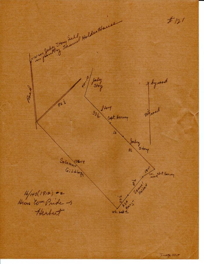
Three maps of Long Society property lines in 1812
1812 (Earliest/Latest dates)
Pencil on paper
Coll. 003 Fold. 069 Doc. 005 Three maps of Long Society property lines in 1812
Hand-drawn in pencil. Third map appears to be a draft of the first as they show the same parcels of land. Some parts are crossed of on the third and absent on the first. Back of both pages are blank. Second map is completely crossed out. Consists of two pieces of paper. Second map is on the back of the first. Back of third map is blank. Previously bother but loose in folder. Now held together by plastic paperclip.
Hand-drawn in pencil. Third map appears to be a draft of the first as they show the same parcels of land. Some parts are crossed of on the third and absent on the first. Back of both pages are blank. Second map is completely crossed out. Consists of two pieces of paper. Second map is on the back of the first. Back of third map is blank. Previously bother but loose in folder. Now held together by plastic paperclip.
Coll. 003 Fold. 069 Doc. 005