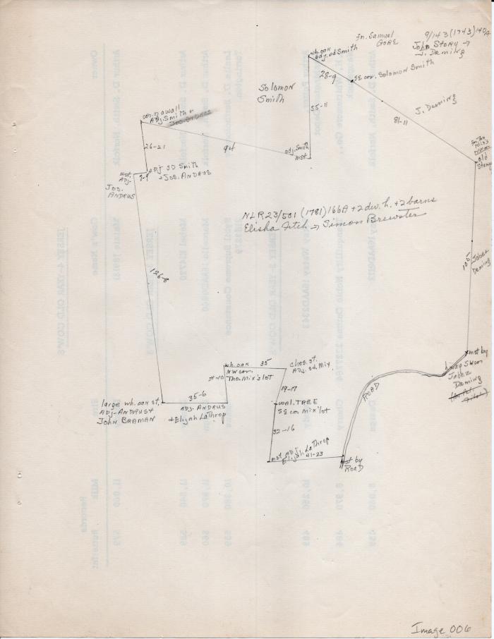
Map of Long Society property lines c. 1781
1781 (Earliest/Latest dates)
1743 (Earliest/Latest dates)
1743 (Earliest/Latest dates)
pencil and ink on paper
11 in H
X
8.5 in W
Coll. 003 Fold. 069 Doc. 006 Map of Long Society property lines c. 1781
Map hand drawn in pencil on the back of a list of dairy cows.
Map hand drawn in pencil on the back of a list of dairy cows.
Coll. 003 Fold. 069 Doc. 006