Maps of Long Society property lines c. 1787
1787 (Earliest/Latest dates)
pencil and ink on paper
11 in H
X
8.5 in W
Coll. 003 Fold. 069 Doc..011 Maps of Long Society property lines c. 1787
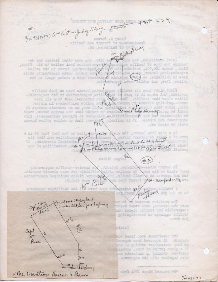
Two maps: one hand drawn in pencil on the back of a typed essay on road engineering. A smaller brown piece of paper appears to be glues to the main piece of paper with the second map drawn on it. There are numerous mathematical calculations written in pencil within the margins of the essay. Removed staple.
Two maps: one hand drawn in pencil on the back of a typed essay on road engineering. A smaller brown piece of paper appears to be glues to the main piece of paper with the second map drawn on it. There are numerous mathematical calculations written in pencil within the margins of the essay. Removed staple.
Coll. 003 Fold. 069 Doc. 011