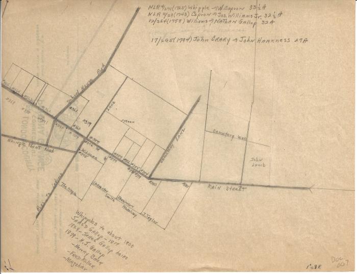
Diagram of Poquetanuck property ownership before 1800
1725 – 1879 (Earliest/Latest dates)
8.5" H
X
11" W
Coll. 003 Fold. 075 Doc. 007 Diagram of Poquetanuck property ownership before 1800
One letter-size yellowed paper with a pencil hand drawing of Poquetanuck property. Drawing shows numbered property along the current Rte. 2A and labels with property owner names.
One letter-size yellowed paper with a pencil hand drawing of Poquetanuck property. Drawing shows numbered property along the current Rte. 2A and labels with property owner names.
Coll. 003 Fold. 075 Doc. 007