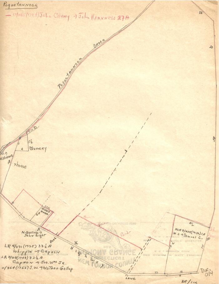
Poquetannock land drawing
1725 – 1742 (Earliest/Latest dates)
11" H
X
8.5" W
Coll. 003 Fold. 075 Doc. 014 Poquetannock land drawing
One letter-size beige paper hand drawn and written in pencil. Opposite side is irrelevant. Some of drawing in red and labeled. Drawing shows the owners of land along the current Route 2A in Poquetannuck.
One letter-size beige paper hand drawn and written in pencil. Opposite side is irrelevant. Some of drawing in red and labeled. Drawing shows the owners of land along the current Route 2A in Poquetannuck.
Coll. 003 Fold. 075 Doc. 014