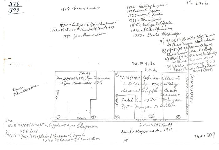
Lot Diagram #376 and #377
1787 (Earliest/Latest dates)
1812 – 1815 (Earliest/Latest dates)
1820 (Earliest/Latest dates)
1868 (Earliest/Latest dates)
1812 – 1815 (Earliest/Latest dates)
1820 (Earliest/Latest dates)
1868 (Earliest/Latest dates)
6" H
X
9" W
Coll. 003 Fold. 091 Doc. 007 Lot Diagram #376 and #377
Half sheet of letter-sized paper with pencil drawing of land distribution. The numbers 376-377 is written in ink in the upper left hand corner. Very detailed information about land ownership in Poquetanuck up to 1868.
Half sheet of letter-sized paper with pencil drawing of land distribution. The numbers 376-377 is written in ink in the upper left hand corner. Very detailed information about land ownership in Poquetanuck up to 1868.
Coll. 003 Fold. 091 Doc. 007